Master QGIS 2024: Complete GIS Course for Beginners to Pro
Focused View
4:37:14
1 -Section outline.mp4
00:45
2 -Intended audience.mp4
02:07
3 -Course outline.mp4
01:22
4 -Who am I.mp4
00:43
1 -Download QGIS.mp4
00:55
1 -qgis website.zip
2 -Install QGIS.mp4
01:07
3 -Opening QGIS for the first time.mp4
00:42
4 -Overview of the QGIS interface.mp4
02:08
5 -Setting up a project template.mp4
02:43
6 -Navigating your data in QGIS.mp4
02:15
1 -Adding data layers.mp4
03:43
2 -Layer styling and symbology.mp4
12:49
3 -Customising QGIS layout.mp4
02:49
4 -Labelling features.mp4
05:08
5 -Setting projections.mp4
02:49
1 -Managing layers.mp4
03:54
2 -Managing symbology.mp4
02:33
3 -Attribute table.mp4
04:23
4 -Data filtering.mp4
04:27
5 -Data querying.mp4
02:07
6 -Data editing.mp4
05:12
7 -Field calculations.mp4
02:14
8 -Joining layers.mp4
02:28
1 -Measuring distances.mp4
03:53
2 -Buffering and dissolving.mp4
05:10
3 -Spatial joins.mp4
02:39
4 -Clipping and intersecting.mp4
04:38
5 -Processing toolbox.mp4
02:23
6 -Advanced selection techniques.mp4
03:24
1 -Custom symbols - part 1.mp4
02:48
2 -Custom symbols - part 2.mp4
02:29
3 -Custom symbols - part 3.mp4
03:22
4 -Custom symbols - part 4.mp4
04:21
5 -Layer transparency.mp4
01:44
6 -Scale-based visibility.mp4
01:44
7 -Exporting high-quality maps.mp4
05:05
8 -Advanced labelling techniques - part 1.mp4
08:04
9 -Advanced labelling techniques - part 2.mp4
07:57
1 -Basic raster actions.mp4
03:55
2 -Raster symbology.mp4
08:04
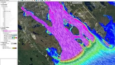
3 -Raster terrain analysis.mp4
21:46
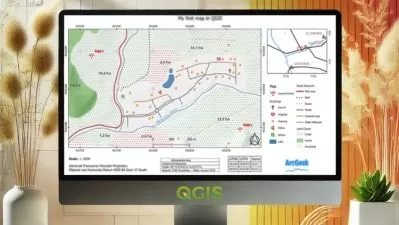
1 -Map layouts and map elements.mp4
11:06
2 -Atlas creation.mp4
07:35
1 -Plugins overview.mp4
02:42
2 -Plugins installation and management.mp4
03:47
3 -Open Topography DEM Downloader.mp4
02:06
4 -QGIS 2 ThreeJS.mp4
09:20
5 -QNEAT3.mp4
01:31
5 -calculate iso areas service areas using qneat3.zip
5 -locating nearest facility with origin-destination matrix (qgis3).zip
5 -qneat3 qgis network analysis capabilities.zip
5 -qneat3 - qgis network analysis toolbox 3.zip
5 -qneat3 - qgis network analysis toolbox 3 (research gate).zip
5 -roel van de paar.zip
6 -Plugin speedrun.mp4
08:01
7 -Orfeo Toolbox extension.mp4
04:11
7 -orfeo toolbox.zip
8 -Python - Layer names.mp4
04:44
9 -Python - Buffer layer.mp4
04:35
10 -Python - Create layer and features.mp4
07:26
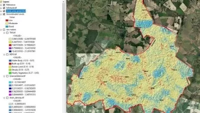
1 -Temporal heatmap.mp4
05:25
2 -Weighted heatmap.mp4
04:49
3 -Density heatmap.mp4
06:27
4 -DBScan clustering.mp4
02:15
5 -K-Means clustering.mp4
01:15
6 -Graphical modeller.mp4
04:35
7 -Cloud Optimised Point Clouds (COPC).mp4
08:52
1 -XYZ tile layers.mp4
02:05
1 -the 10 best free-to-use map layers (daniel van der maas).zip
2 -WMSWMTS layers.mp4
01:19
2 -the 10 best free-to-use map layers (daniel van der maas).zip
3 -Web mapping using qgis2web.mp4
06:50
4 -PostGIS database.mp4
02:01
5 -ArcGIS REST server.mp4
01:28
5 -lakecounty taxdistricts (featureserver).zip
More details
Course Overview
Go from QGIS beginner to advanced user with this comprehensive course covering everything from basic map creation to spatial analysis and web mapping.
What You'll Learn
- Create professional maps and manage geospatial data
- Perform advanced spatial analysis and terrain modeling
- Extend QGIS functionality with plugins and Python
Who This Is For
- GIS beginners with no prior QGIS experience
- Geospatial professionals upgrading their skills
- Researchers and analysts working with spatial data
Key Benefits
- Hands-on training with real-world applications
- Covers both basic and advanced QGIS techniques
- Learn industry-standard spatial analysis methods
Curriculum Highlights
- QGIS Fundamentals & Interface
- Data Management & Styling
- Advanced Spatial Analysis
Focused display
Category
- language english
- Training sessions 65
- duration 4:37:14
- Release Date 2025/04/15