Master WebGIS Development: Complete 2024 Guide
Focused View
18:01:08
1 -Introduction to the Course.mp4
04:09
2 -WebGIS.pptx
2 -What is WebGIS.mp4
06:12
3 -Final WebGIS Portal that We Will Develope.mp4
11:20
1 -Installing Xampp.mp4
02:47
2 -Installing Sublime Text.mp4
07:28
3 -HTML Basics (Part-1).mp4
19:22
3 -training html.zip
4 -HTML Basics (Part-2).mp4
15:07
1 -CSS Basics.mp4
15:40
2 -Bootstrap Basics (Part-1).mp4
10:06
3 -Bootstrap Basics (Part-2).mp4
12:47
1 -JavaScript Basics (Part-1).mp4
19:11
2 -JavaScript Basics (Part-2).mp4
24:15
3 -Document Object Model (DOM) Manipulation with JavaScript.mp4
22:35
4 -Introduction to jQuery.mp4
04:40
5 -JavaScript Problem Solving.mp4
20:31
1 -Introduction to Mapping Libraries.mp4
07:24
2 -Introduction to Leaflet.mp4
06:12
2 -Shapefiles.zip
2 -first webmap.zip
3 -Initiating First Webmap (Part-1).mp4
10:02
4 -Initiating First Webmap (Part-2).mp4
09:37
5 -Adding Multiple Basemaps.mp4
06:59
6 -Leaflet Plugins (Sidebar, Easy Button, Scale Bar).mp4
18:46
7 -Leaflet Plugins (Mearure Tool and Mouse Position).mp4
09:17
8 -Leaflet Plugins (Draw Control and Minimap).mp4
17:29
9 -Leaflet Map Controls (Zoom and Layer Control).mp4
07:18
10 -Introduction to GeoJSON.mp4
12:36
11 -Advantages of GeoJSON and Validating it.mp4
09:18
12 -Loading Point Features in Leaflet.mp4
11:13
13 -Styling Point Features in Leaflet.mp4
19:31
14 -Loading and Styling Line Features in Leaflet.mp4
14:52
15 -Loading and Styling Polygon Features in Leaflet.mp4
17:05
16 -Developing and Creating Contents in the Sidebar.mp4
09:13
17 -Attribute Query in Leaflet.mp4
16:16
18 -Querying and Displaying Point Features.mp4
14:37
19 -Querying and Displaying Line Features.mp4
15:57
20 -Querying and Displaying Polygon Features.mp4
09:08
1 -Introduction to PostgreSQL and PostGIS.mp4
12:57
2 -How to Install PostgreSQL and PostGIS.mp4
06:16
3 -Set Up PostgreSQL with PostGIS and Connect to QGIS.mp4
11:10
4 -Uploading Spatial Data to PostgreSQL.mp4
08:02
1 -Introduction to SQL and Create Operation.mp4
10:42
2 -Select Operations in SQL.mp4
16:03
3 -Update Statements in SQL.mp4
06:01
4 -Delete Operations in SQL.mp4
05:28
5 -Some Necessary Commands in SQL.mp4
04:28
6 -Data Cleaning (Part-1).mp4
09:36
7 -Data Cleaning (Part-2).mp4
10:07
1 -Introduction to Cloud Based PostgreSQL Instances.mp4
09:49
2 -Creating a Free PostgreSQL Instance on the Cloud.mp4
07:15
3 -Connecting with the Remote PostgreSQL Instance.mp4
05:33
4 -Loading Data into Remote PostgreSQL Instance and Creating Backups.mp4
09:24
5 -Creating Spatial Indexing in PostgreSQL.mp4
06:16
1 -PHP Basics for Developing WebGIS Portals.mp4
24:33
1 -training php.zip
2 -Performing GET and POST Request in PHP.mp4
08:30
3 -Establishing Connection with PostgreSQL Instance and Reading Data.mp4
10:56
4 -Data Validation and Insert Data into PostgreSQL (Part-1).mp4
13:23
5 -Data Validation and Insert Data into PostgreSQL (Part-2).mp4
09:32
6 -Data Validation and Insert Data into PostgreSQL (Part-3).mp4
05:16
1 -GeoJSON Data.zip
1 -Modifying Graphical User Interface (Part-1).mp4
10:04
1 -webgis.zip
2 -Modifying Graphical User Interface (Part-2).mp4
13:00
3 -Loading and Displaying Point Features from Server (Part-1).mp4
11:59
4 -Loading and Displaying Point Features from Server (Part-2).mp4
16:55
5 -Loading and Displaying Point Features from Server (Part-3).mp4
15:04
6 -Loading and Displaying Point Features from Server (Part-4).mp4
10:48
7 -Loading and Displaying MultiLine and MultiPolygon Features from Server.mp4
12:54
8 -Querying Database and Displaying the Result (Part-1).mp4
17:51
9 -Querying Database and Displaying the Result (Part-2).mp4
03:47
10 -Querying Database and Displaying the Result (Part-3).mp4
07:45
11 -Modifying User Interface for Data Insertion.mp4
12:57
12 -Creating GeoJSON from Draw Controls or Geoman.mp4
19:56
13 -Real Time Data Insertion (Part-1).mp4
11:06
14 -Real Time Data Insertion (Part-2).mp4
13:50
15 -Automatic Data Syncing Amount Multiple Systems.mp4
16:37
16 -Real Time Data Insertion (Part-3).mp4
15:35
17 -Real Time Data Insertion (Part-4).mp4
12:04
18 -Modifying User Interface for Data Updating.mp4
17:16
19 -Real Time Data Update and Delete (Part-1).mp4
09:00
20 -Real Time Data Update and Delete (Part-2).mp4
07:59
21 -Real Time Data Update and Delete (Part-3).mp4
15:39
22 -Integrating Sweet Alert into WebGIS Portal.mp4
13:36
23 -Real Time Data Update and Delete (Part-4).mp4
11:44
24 -Real Time Data Update and Delete (Part-5).mp4
10:18
25 -CRUD Operations Completed.mp4
17:28
26 -Filtering Multiple Study Areas (Part-1).mp4
19:40
27 -Filtering Multiple Study Areas (Part-2).mp4
16:19
28 -Filtering Multiple Study Areas (Part-3).mp4
03:49
1 -What is Tiling.mp4
04:33
2 -DMA 911B.pdf
2 -Preparing Raster Data.mp4
09:52
2 -Zone1.rar
2 -dma 105 boundary.rar
3 -Making Tiles from Raster Data.mp4
06:48
4 -Displaying Raster Data.mp4
12:41
1 -Getting a Hosting and Domain Name.mp4
12:54
2 -Bringing the WebGIS Portal Online.mp4
12:35
3 -Ending Remarks.mp4
02:40
1 -Shortcut to Upload Raster Data to Hosting.mp4
03:48
More details
Course Overview
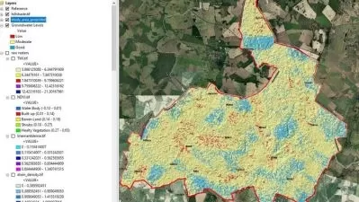
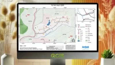
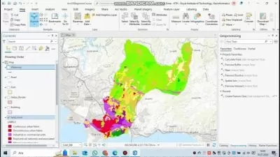
This comprehensive course takes you from beginner to advanced WebGIS developer, teaching you to build interactive mapping platforms using cutting-edge technologies like Leaflet, PostgreSQL, and PHP.
What You'll Learn
- Create dynamic web maps with Leaflet and jQuery
- Manage spatial data using PostgreSQL and PostGIS
- Develop server-side functionality with PHP for real-time updates
Who This Is For
- GIS professionals expanding into web development
- Students pursuing advanced geospatial skills
- Anyone interested in building interactive mapping applications
Key Benefits
- No prior programming experience required
- Hands-on projects including a complete WebGIS portal
- Learn to host and deploy your mapping applications
Curriculum Highlights
- Web development fundamentals (HTML, CSS, JavaScript)
- Interactive mapping with Leaflet plugins
- Database management with PostgreSQL/PostGIS
Focused display
Category
- language english
- Training sessions 93
- duration 18:01:08
- Release Date 2025/06/07